AI Video Analytics for Drone Traffic & Multi-Object Tracking
A drone video analytics system that detects and tracks vehicles/pedestrians across aerial footage with persistent IDs.
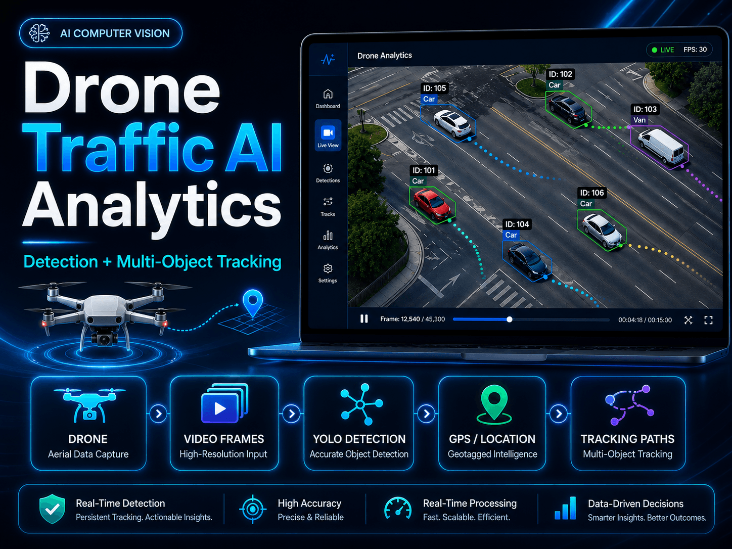
Workflow & Architecture
How this system works
Drone footage ingested frame by frame for traffic analysis.
Fine-tuned YOLOv11 detects vehicles and pedestrians in each frame.
BoT-SORT maintains persistent IDs through occlusion and camera motion.
Trajectories, counts, and annotated video for monitoring and reporting.
Overview
Combined a fine-tuned YOLOv11 detector with BoT-SORT multi-object tracking to maintain persistent object identities across frames, with camera-motion compensation for stability during drone movement.
The Problem
Raw aerial footage needs to be turned into structured, trackable data for traffic monitoring and smart-city applications.
The Solution
Built a computer vision pipeline with fine-tuned YOLOv11 detection, BoT-SORT tracking, camera motion compensation, and annotated outputs with bounding boxes and tracking IDs.
Key Features
- Fine-tuned YOLOv11 detection for vehicles and pedestrians on aerial video
- BoT-SORT tracking for persistent IDs through occlusion and dense traffic
- Camera motion compensation for stable tracking in moving drone footage
- Trajectory tracking for movement-pattern analysis
- Annotated output with bounding boxes, class labels, and tracking IDs
Outcomes & Business Value
- Converts raw aerial video into structured, analyzable data
- Enables traffic monitoring, vehicle counting, and smart-city planning
- Foundation for zone analytics and surveillance reporting